1992
NJ5217 : River Don at Slaskie Pot
taken 32 years ago, near to Auchintoul, Aberdeenshire, Scotland
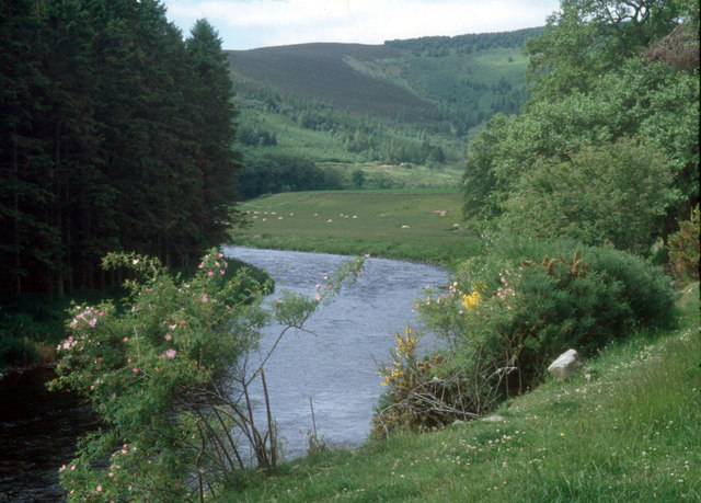
River Don at Slaskie Pot
The Don here winds through pastoral valley bottom and forested hillsides
 Map © Crown Copyright")
TIP: Click the map for more Large scale mapping
- Grid Square
- NJ5217, 9 images (more nearby 🔍)
- Photographer
- Alan Reid (more nearby)
- Date Taken
- May 1992 (more nearby)
- Submitted
- Sunday, 28 April, 2013
- Subject Location
-
OSGB36:
 NJ 5261 1718 [10m precision]
WGS84: 57:14.5713N 2:47.2115W - Camera Location
-
OSGB36: NJ 5268 1726
- View Direction
- Southwest (about 225 degrees)