1989
HT9340 : The Kame of Foula
taken 35 years ago, near to Harrier, Foula, Shetland Islands, Scotland
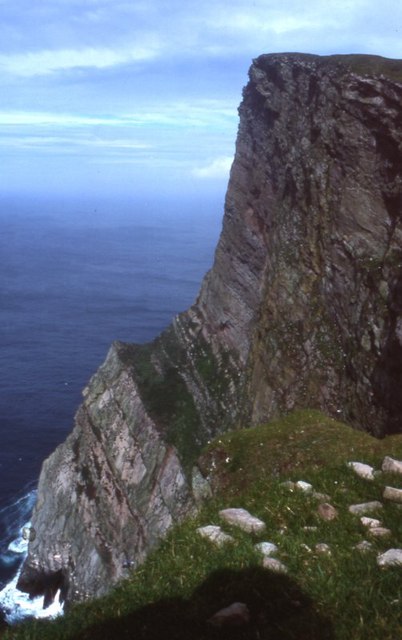
The Kame of Foula
Britain's highest cliff (unless, like some, you think that the 'ledge' halfway down disqualifies it). It is, of course, impossible to take a meaningful photograph wholly within the square. In fact, it is probably impossible to stand up on two feet within the square!
 Map © Crown Copyright")
TIP: Click the map for more Large scale mapping
- Grid Square
- HT9340, 3 images (more nearby 🔍)
- Photographer
- Mike Pennington (more nearby)
- Date Taken
- Saturday, 19 August, 1989 (more nearby)
- Submitted
- Thursday, 22 February, 2007
- Subject Location
-
OSGB36:
 HT 939 401 [100m precision]
WGS84: 60:8.7216N 2:6.6124W - Camera Location
-
OSGB36: HT 938 397
- View Direction
- North-northeast (about 22 degrees)