2007
SU3362 : Farm track near Ham
taken 17 years ago, near to Ham, Wiltshire, England
Farm track near Ham
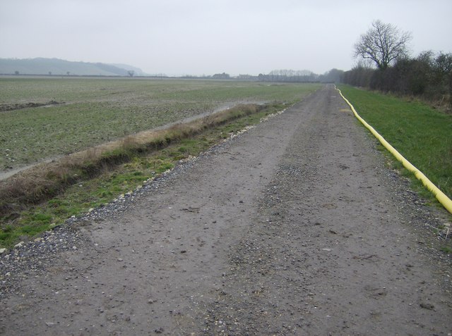
Looking west from eastern edge of square. Significant farm track running through the centre of the square. The farmland to the south (left) is flat for a few hundred metres before rising steeply at the southern edge. The yellow pipe seems to be a water pipe and runs along the whole length of the track from the road at the western end.
 Map © Crown Copyright")
TIP: Click the map for more Large scale mapping
- Grid Square
- SU3362, 13 images (more nearby 🔍)
- Photographer
- Graham Horn (more nearby)
- Date Taken
- Saturday, 17 February, 2007 (more nearby)
- Submitted
- Friday, 23 February, 2007
- Subject Location
-
OSGB36:
 SU 337 626 [100m precision]
WGS84: 51:21.6992N 1:31.0245W - Camera Location
-
OSGB36: SU 339 626
- View Direction
- WEST (about 270 degrees)