2013
SK5545 : Bestwood NG5, Notts
taken 11 years ago, near to Bulwell, Nottingham, England
This is 1 of 5 images, with title Bestwood NG5, Notts. in this square
Bestwood NG5, Notts.
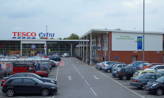
It may be the case that Tesco plc. secured planning permission for the construction of this large supermarket following agreement to build this Community Centre that now houses clinic facilities and health worker's offices. These facilities are seen here from a short, elevated path that joins the nearby A611 (Hucknall Road).
 Map © Crown Copyright")
TIP: Click the map for more Large scale mapping
- Grid Square
- SK5545, 26 images (more nearby 🔍)
- Photographer
- David Hallam-Jones (more nearby)
- Date Taken
- Friday, 17 May, 2013 (more nearby)
- Submitted
- Friday, 17 May, 2013
- Subject Location
-
OSGB36:
 SK 5516 4531 [10m precision]
WGS84: 53:0.1366N 1:10.7696W - Camera Location
-
OSGB36: SK 5513 4531
- View Direction
- East-northeast (about 67 degrees)