2013
SW4841 : Pen Enys Point - west side
taken 11 years ago, 3 km from Halsetown, Cornwall, England
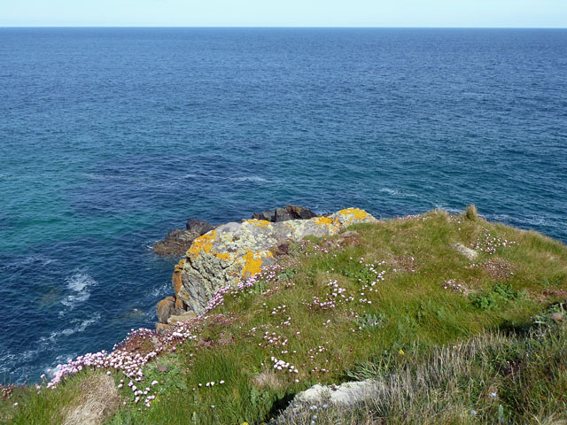
Pen Enys Point - west side
Polgassick Rock is mostly hidden by the rock outcrop at the cliff top. Thrift was abundant.
 Map © Crown Copyright")
TIP: Click the map for more Large scale mapping
- Grid Square
- SW4841, 14 images (more nearby 🔍)
- Photographer
- Robin Webster (more nearby)
- Date Taken
- Friday, 17 May, 2013 (more nearby)
- Submitted
- Monday, 20 May, 2013
- Subject Location
-
OSGB36:
 SW 4898 4110 [10m precision]
WGS84: 50:12.9915N 5:31.2034W - Camera Location
-
OSGB36: SW 48999 41099
- View Direction
- Northwest (about 315 degrees)