2007
NZ1123 : Scotland Lane
taken 17 years ago, near to Burnt Houses, County Durham, England
This is 1 of 2 images, with title Scotland Lane in this square
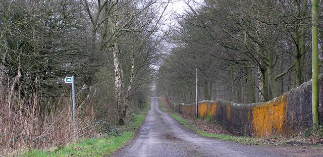
Scotland Lane
The wall on the right marks the northern boundary of Raby Castle estate, looking toward Burnt Houses. The Footpath on the left, to Hollymoor.
 Map © Crown Copyright")
TIP: Click the map for more Large scale mapping
- Grid Square
- NZ1123, 18 images (more nearby 🔍)
- Photographer
- Hugh Mortimer (more nearby)
- Date Taken
- Sunday, 25 February, 2007 (more nearby)
- Submitted
- Sunday, 25 February, 2007
- Subject Location
-
OSGB36:
 NZ 114 234 [100m precision]
WGS84: 54:36.3817N 1:49.4833W - Camera Location
-
OSGB36: NZ 110 235
- View Direction
- East-southeast (about 112 degrees)