2013
NN6323 : The Haugh
taken 11 years ago, near to Ardvorlich, Perth And Kinross, Scotland
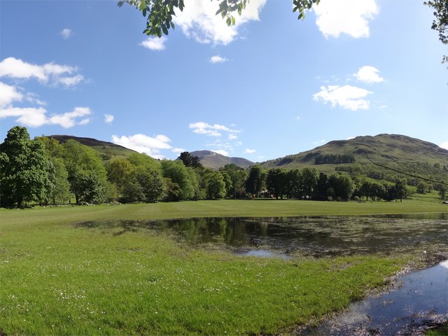
The Haugh
Named on larger scale maps as The Haugh - the land in front of Ardvorlich House, partially flooded after a wet spring. A few more days like today will start to dry it out. In the distance is the munro of Ben Vorlich.
 Map © Crown Copyright")
TIP: Click the map for more Large scale mapping
- Grid Square
- NN6323, 36 images (more nearby 🔍)
- Photographer
- Adam Ward (more nearby)
- Date Taken
- Sunday, 2 June, 2013 (more nearby)
- Submitted
- Tuesday, 11 June, 2013
- Subject Location
-
OSGB36:
 NN 6323 2311 [10m precision]
WGS84: 56:22.8258N 4:12.9905W - Camera Location
-
OSGB36: NN 6324 2321
- View Direction
- SOUTH (about 180 degrees)