2013
NY6900 : Stockless Gill rising north
taken 11 years ago, near to Adamthwaite, Cumbria, England
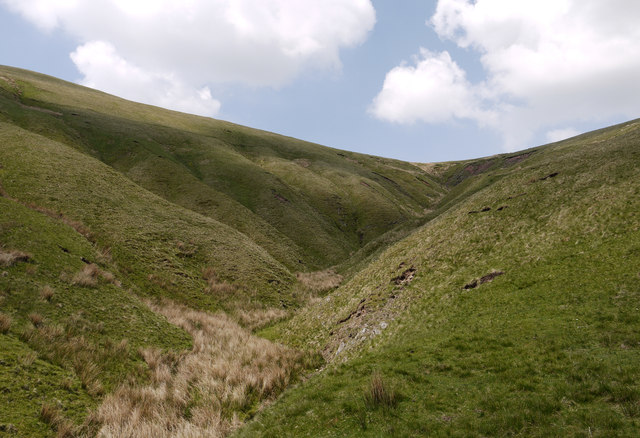
Stockless Gill rising north
The stream rises between Randygill Top (left) and Stockless (right).
OS mapping is odd hereabouts; at larger scales the stream rising north is named as Stockless Gill but at the 1:25 000 scale the name is placed elsewhere as if the stream here is just a tributary of it. Also mapping at 1:50 000 shows the photographer and subject positions to the west of the stream when both were certainly on the east side - and the camera location was recorded as an 8-figure grid reference.
OS mapping is odd hereabouts; at larger scales the stream rising north is named as Stockless Gill but at the 1:25 000 scale the name is placed elsewhere as if the stream here is just a tributary of it. Also mapping at 1:50 000 shows the photographer and subject positions to the west of the stream when both were certainly on the east side - and the camera location was recorded as an 8-figure grid reference.
 Map © Crown Copyright")
TIP: Click the map for more Large scale mapping
- Grid Square
- NY6900, 17 images (more nearby 🔍)
- Photographer
- Trevor Littlewood (more nearby)
- Date Taken
- Friday, 7 June, 2013 (more nearby)
- Submitted
- Thursday, 13 June, 2013
- Subject Location
-
OSGB36:
 NY 6936 0024 [10m precision]
WGS84: 54:23.8022N 2:28.4055W - Camera Location
-
OSGB36: NY 6942 0013
- View Direction
- North-northwest (about 337 degrees)