2013
NY9446 : Whiteheaps Mine road
taken 11 years ago, near to Townfield, County Durham, England
Whiteheaps Mine road
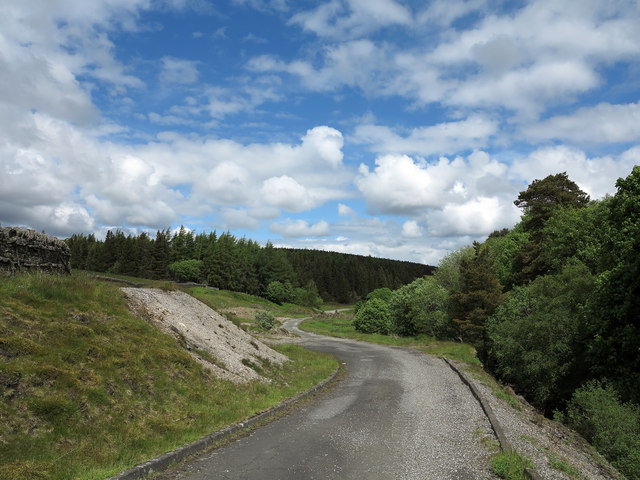
This tarmacked road once served the Whiteheaps Mine which was worked for various minerals over its lifetime, not closing finally until 1987; the mine site itself has virtually been cleared. Evidence of older processing at the site is the pale bank at the left side of the image - crushed material that was discarded once the desired mineral had been extracted.
 Map © Crown Copyright")
TIP: Click the map for more Large scale mapping
- Grid Square
- NY9446, 15 images (more nearby 🔍)
- Photographer
- Trevor Littlewood (more nearby)
- Date Taken
- Sunday, 16 June, 2013 (more nearby)
- Submitted
- Sunday, 16 June, 2013
- Subject Location
-
OSGB36:
 NY 9493 4699 [10m precision]
WGS84: 54:49.0641N 2:4.8254W - Camera Location
-
OSGB36: NY 9494 4693
- View Direction
- NORTH (about 0 degrees)