2013
TQ5235 : Footbridge near Rock's Wood
taken 11 years ago, near to Boarshead, East Sussex, England
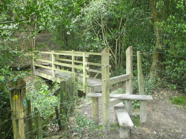
Footbridge near Rock's Wood
This bridge is on the High Weald Landscape Trail heading into Rock's Wood. The long distance path leads through the wood to head to Corseley Road and Mott's Mill.
The bridge crosses over Mottsmill Stream.
The bridge crosses over Mottsmill Stream.
High Weald Landscape Trail
This is 140 km /90 mile route crosses West Sussex, East Sussex and Kent. It gives walkers the chance to explore the very heart of south east England. The trail links ridge top villages and famous historic gardens. It wanders through a rolling landscape of small fields, hop gardens, orchards, flower-rich meadows and ancient woodlands, studded with ponds, sandstone outcrops and heavy clay fields.
See Linkfor more details on the route. For more details on how to explore the route, see Link
 Map © Crown Copyright")
TIP: Click the map for more Large scale mapping
- Grid Square
- TQ5235, 75 images (more nearby 🔍)
- Photographer
- David Anstiss (more nearby)
- Date Taken
- Saturday, 15 June, 2013 (more nearby)
- Submitted
- Tuesday, 18 June, 2013
- Subject Location
-
OSGB36:
 TQ 5209 3500 [10m precision]
WGS84: 51:5.6488N 0:10.2317E - Camera Location
-
OSGB36: TQ 5209 3500
- View Direction
- North-northwest (about 337 degrees)