2006
SK1502 : The Ford at Hints
taken 17 years ago, near to Hints, Staffordshire, England
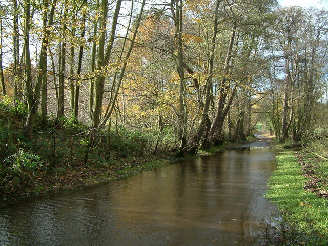
The Ford at Hints
This is the point where Rookery Lane crosses Black Brook and the river changes name to Bourne Brook. Nowadays,water only flows along the road after heavy rain. During drier spells, the river follows the original course under the road higher up.
 Map © Crown Copyright")
TIP: Click the map for more Large scale mapping
- Grid Square
- SK1502, 13 images (more nearby 🔍)
- Photographer
- Dave Toy (more nearby)
- Date Taken
- Sunday, 26 November, 2006 (more nearby)
- Submitted
- Saturday, 3 March, 2007
- Subject Location
-
OSGB36:
 SK 155 028 [100m precision]
WGS84: 52:37.3809N 1:46.3126W - Camera Location
-
OSGB36: SK 155 028
- View Direction
- Southwest (about 225 degrees)