2013
SN7313 : Cefnbrynbrain Cycle Path
taken 11 years ago, near to Cwmllynfell, Neath Port Talbot/Castell-Nedd Port Talbot, Wales
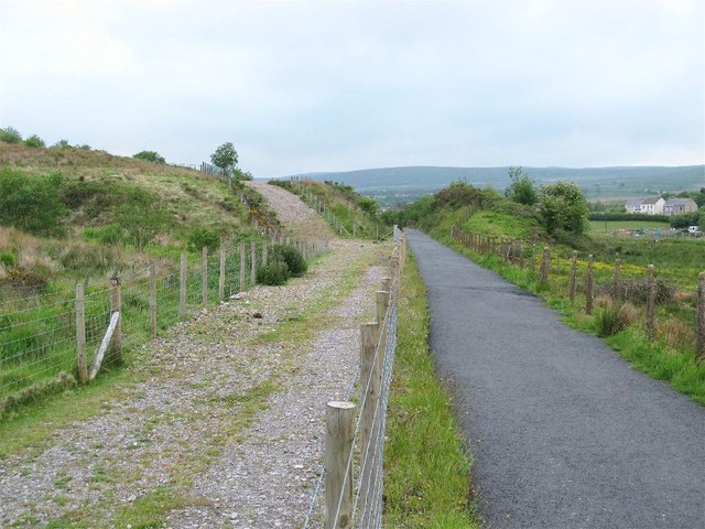
Cefnbrynbrain Cycle Path
This cyclepath has been built on a section of dismantled railway between Cefnbrynbrain and Rhosaman. This shot is in the direction of Rhosaman where the railway descends through a cutting. Beside the cyclepath is a relatively recently created track which diverts away from the cutting as it borders the Celtic Energy East Pit open cast SN7313 : Opencast mine and its spoil tip.
 Map © Crown Copyright")
TIP: Click the map for more Large scale mapping
- Grid Square
- SN7313, 17 images (more nearby 🔍)
- Photographer
- Nigel Davies (more nearby)
- Date Taken
- Saturday, 15 June, 2013 (more nearby)
- Submitted
- Sunday, 30 June, 2013
- Subject Location
-
OSGB36:
 SN 7358 1364 [10m precision]
WGS84: 51:48.4237N 3:50.1031W - Camera Location
-
OSGB36: SN 7363 1360
- View Direction
- Northwest (about 315 degrees)