2013
SD6086 : Benchmark at NE side of road, Egholme Peat Moss
taken 11 years ago, near to Middleton, Cumbria, England
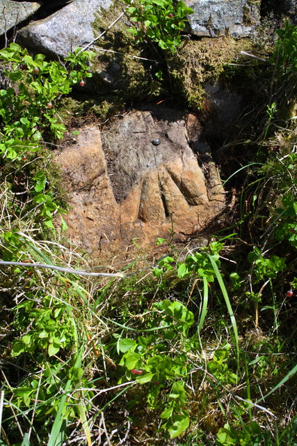
Benchmark at NE side of road, Egholme Peat Moss
Ordnance Survey rivet benchmark described on the Bench Mark Database at Link
 Map © Crown Copyright")
TIP: Click the map for more Large scale mapping
- Grid Square
- SD6086, 18 images (more nearby 🔍)
- Photographer
- Roger Templeman (more nearby)
- Date Taken
- Tuesday, 4 June, 2013 (more nearby)
- Submitted
- Sunday, 30 June, 2013
- Subject Location
-
OSGB36:
 SD 6026 8625 [10m precision]
WGS84: 54:16.2209N 2:36.7024W - Camera Location
-
OSGB36: SD 6026 8625
- View Direction
- North-northeast (about 22 degrees)