1998
NS3235 : Site of Gailes station, 1998
taken 26 years ago, 3 km from Dreghorn, North Ayrshire, Scotland
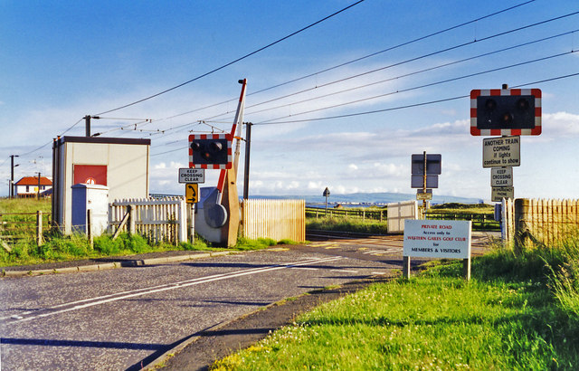
Site of Gailes station, 1998
View SW, towards (to left) Ayr, Girvan and Stranraer: ex-G&SWR Glasgow (St Enoch until 6/66, then Central)- Ayr - Stranraer main line, electrified to Ayr in 9/86. Gailes station (on the left) was closed from 2/1/67, by which time all the golfers at the local Golf Course for whom it was provided were coming by car. (See the noticeboard and cf. NS3235 : Western Gailes).
 Map © Crown Copyright")
TIP: Click the map for more Large scale mapping
- Grid Square
- NS3235, 33 images (more nearby 🔍)
- Photographer
- Ben Brooksbank (more nearby)
- Date Taken
- Saturday, 27 June, 1998 (more nearby)
- Submitted
- Sunday, 14 July, 2013
- Subject Location
-
OSGB36:
 NS 321 355 [100m precision]
WGS84: 55:35.0811N 4:39.8495W - Camera Location
-
OSGB36: NS 321 355
- View Direction
- Southwest (about 225 degrees)