2013
SW8769 : Church of St Uvelus, St Eval
taken 11 years ago, near to Engollan, Cornwall, England
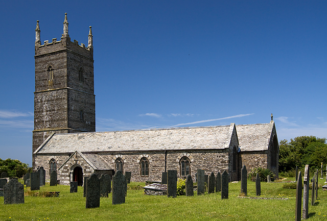
Church of St Uvelus, St Eval
At one time the church was perched on the periphery of the former RAF station and its airfield. Now all is peace amongst fields, much of the area having been returned to agriculture. However, there is currently a Karting track on part of the old runway, and a transmitter station with its aerial farm is also nearby, making for an odd juxtaposition with the Norman church, something it has had to get used to over the last 70 years.
 Map © Crown Copyright")
TIP: Click the map for more Large scale mapping
- Grid Square
- SW8769, 17 images (more nearby 🔍)
- Photographer
- Mike Searle (more nearby)
- Date Taken
- Saturday, 13 July, 2013 (more nearby)
- Submitted
- Thursday, 18 July, 2013
- Subject Location
-
OSGB36:
 SW 8718 6918 [10m precision]
WGS84: 50:29.0216N 5:0.0778W - Camera Location
-
OSGB36: SW 8719 6915
- View Direction
- North-northwest (about 337 degrees)