2007
NT9661 : Low tide at Burnmouth Bay
taken 17 years ago, near to Burnmouth, Scottish Borders, Scotland
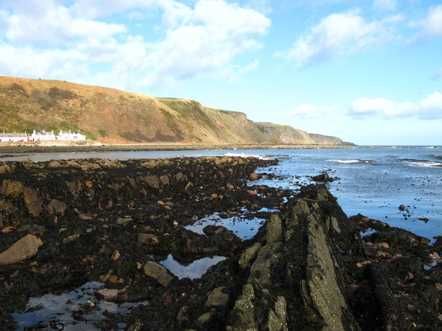
Low tide at Burnmouth Bay
Rocks exposed at low tide. The fishermen's cottages at Partenhall can be seen to the northwest NT9561.
 Map © Crown Copyright")
TIP: Click the map for more Large scale mapping
- Grid Square
- NT9661, 4 images (more nearby 🔍)
- Photographer
- Lisa Jarvis (more nearby)
- Date Taken
- Tuesday, 6 March, 2007 (more nearby)
- Submitted
- Wednesday, 7 March, 2007
- Subject Location
-
OSGB36:
 NT 960 610 [100m precision]
WGS84: 55:50.5644N 2:3.8980W - Camera Location
-
OSGB36: NT 960 610
- View Direction
- North-northwest (about 337 degrees)