2013
NS3974 : Dumbarton Rock and Castle
taken 11 years ago, near to Dumbarton, West Dunbartonshire, Scotland
This is 1 of 16 images, with title Dumbarton Rock and Castle in this square
Dumbarton Rock and Castle
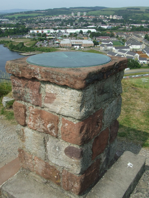
The toposcope at the top of the west peak. See also NS3974 : Dumbarton Rock and Castle.
Dumbarton Rock and Castle :: NS4074
The Rock is a volcanic plug, and it has a long history as a fortified site. For further information, see the Geograph article "Dumbarton Rock and Castle": Link
 Map © Crown Copyright")
TIP: Click the map for more Large scale mapping
- Grid Square
- NS3974, 267 images (more nearby 🔍)
- Photographer
- Thomas Nugent (more nearby)
- Date Taken
- Friday, 12 July, 2013 (more nearby)
- Submitted
- Tuesday, 23 July, 2013
- Subject Location
-
OSGB36:
 NS 3994 7448 [10m precision]
WGS84: 55:56.1988N 4:33.8410W - Camera Location
-
OSGB36: NS 3994 7448
- View Direction
- Southeast (about 135 degrees)