2007
TM0775 : Scama Lane, Burgate
taken 17 years ago, near to Burgate, Suffolk, England
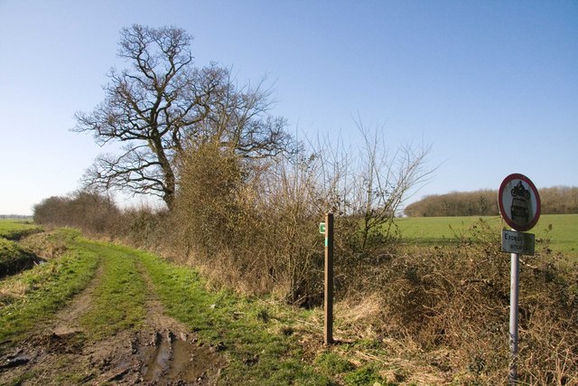
Scama Lane, Burgate
I believe this is a BOAT (Byway Open to All Traffic) which has been the subject of a road closure notice, hence the circular sign to the right prohibiting cars & motorcycles except for access. This means the farmer can drive down it and anyone else can walk or ride a horse along it.
There certainly isn't enough water for a boat even though we have had a lot of rain recently.
There certainly isn't enough water for a boat even though we have had a lot of rain recently.
 Map © Crown Copyright")
TIP: Click the map for more Large scale mapping
- Grid Square
- TM0775, 18 images (more nearby 🔍)
- Photographer
- Charles Greenhough (more nearby)
- Date Taken
- Thursday, 8 March, 2007 (more nearby)
- Submitted
- Thursday, 8 March, 2007
- Subject Location
-
OSGB36:
 TM 070 755 [100m precision]
WGS84: 52:20.3566N 1:2.3077E - Camera Location
-
OSGB36: TM 071 756
- View Direction
- Southwest (about 225 degrees)