TF0820 : Some sort of Symmetry
taken 11 years ago, near to Bourne, Lincolnshire, England
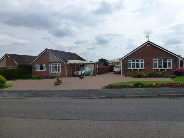
Parker Bros. of Spalding built these houses in the mid 1960s, in their house style. The porches have a flat roof with a steel pole support, the panel below the upstairs window is tile-hung. Although most of these houses are found in the two large estates to the west of the town, they are also scattered here and there whenever 1960s infill occurred.
The Westwood estate to the south of West Road was not 'open plan': rather the houses had vestigial brick garden walls. And they used a cast concrete assembly at the bottom of the roof, instead of soffit boards, with an integral gutter hidden in it. A small number of houses was built near Mill Drove in the same style.
To the North of West Road the slightly later Westbourne and Westfield estates had conventional roof construction with wooden soffits and plastic gutters, and no front boundaries. The houses were thus closer to the road, there being no grass verge.
 Map © Crown Copyright")
- Grid Square
- TF0820, 3474 images (more nearby 🔍)
- Photographer
- Bob Harvey (more nearby)
- Date Taken
- Wednesday, 7 August, 2013 (more nearby)
- Submitted
- Wednesday, 7 August, 2013
- Subject Location
-
OSGB36:
 TF 0866 2065 [10m precision]
WGS84: 52:46.3511N 0:23.4456W - Camera Location
-
OSGB36: TF 0866 2067
- View Direction
- South-southeast (about 157 degrees)