2004
SN7652 : A sunny day in the Doethie Valley!
taken 20 years ago, near to Esgair Gwair [other Features], Ceredigion, Great Britain
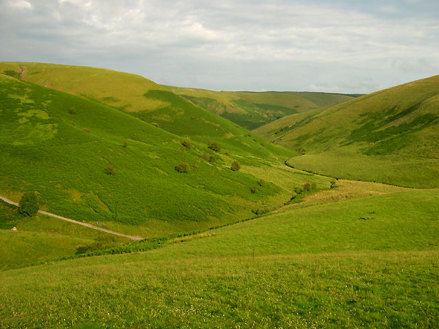
A sunny day in the Doethie Valley!
The Drovers Road to Soar y Mynydd is on the left. The Bridleway which leads south-eastwards down the valley can be seen traversing through the bracken halfway up the picture, continuing round the mid-distance spur beyond Nant y Benglog.
 Map © Crown Copyright")
TIP: Click the map for more Large scale mapping
- Grid Square
- SN7652, 24 images (more nearby 🔍)
- Photographer
- Roger D Kidd (more nearby)
- Date Taken
- Thursday, 22 July, 2004 (more nearby)
- Submitted
- Friday, 9 March, 2007
- Subject Location
-
OSGB36:
 SN 762 527 [100m precision]
WGS84: 52:9.5191N 3:48.6707W - Camera Location
-
OSGB36: SN 754 535
- View Direction
- Southeast (about 135 degrees)