2013
SN7721 : Carreg yr Ogof
taken 11 years ago, 3 km from Llanddeusant, Carmarthenshire/Sir Gaerfyrddin, Wales
This is 1 of 6 images, with title Carreg yr Ogof in this square
Carreg yr Ogof
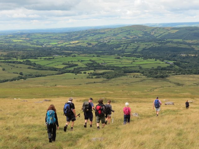
Cerddwyr yn dilyn llwybr i lawr y waered o Garreg yr Ogof at Nant Ffynnon Wen.
Walkers descending along a path from Carreg yr Ogof towards Ffynnon Wen Stream.
Walkers descending along a path from Carreg yr Ogof towards Ffynnon Wen Stream.
 Map © Crown Copyright")
TIP: Click the map for more Large scale mapping
- Grid Square
- SN7721, 19 images (more nearby 🔍)
- Photographer
- Alan Richards (more nearby)
- Date Taken
- Sunday, 11 August, 2013 (more nearby)
- Submitted
- Monday, 12 August, 2013
- Subject Location
-
OSGB36:
 SN 7720 2144 [10m precision]
WGS84: 51:52.6778N 3:47.1207W - Camera Location
-
OSGB36: SN 7734 2134
- View Direction
- Northwest (about 315 degrees)