2013
SJ7417 : Ordnance Survey bench-mark on former railway bridge
taken 11 years ago, near to Church Aston, Telford And Wrekin, England
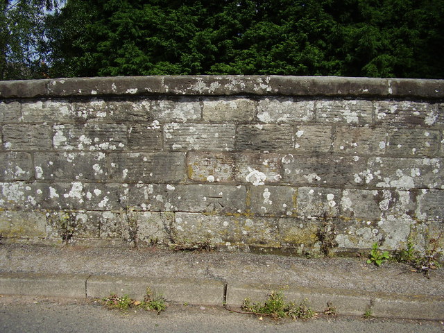
Ordnance Survey bench-mark on former railway bridge
This bench mark was established in 1858 during the First primary levelling, England & Wales, and was levelled with a height of 282.7170 feet [86.1721 metres] above mean sea level (Liverpool datum). It was included as a side level on the Llandysilio to Stafford levelling line. The surveyor's description was No. 84(a). Church Aston Bridge, over railway. Mark on North battlement ; 1.41 ft. above surface (p587).
 Map © Crown Copyright")
TIP: Click the map for more Large scale mapping
- Grid Square
- SJ7417, 17 images (more nearby 🔍)
- Photographer
- Shantavira (more nearby)
- Date Taken
- Friday, 16 August, 2013 (more nearby)
- Submitted
- Saturday, 17 August, 2013
- Subject Location
-
OSGB36:
 SJ 7441 1779 [10m precision]
WGS84: 52:45.4264N 2:22.8370W - Camera Location
-
OSGB36: SJ 7441 1779
- View Direction
- Northeast (about 45 degrees)