2007
NT5575 : Sandy's Mill
taken 17 years ago, 3 km from Athelstaneford, East Lothian, Scotland
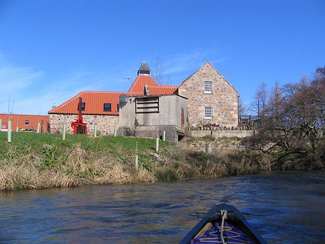
Sandy's Mill
Don't know who Sandy was. The mill is now a house, but the wee building nearby generates electricity from water power.
 Map © Crown Copyright")
TIP: Click the map for more Large scale mapping
- Grid Square
- NT5575, 38 images (more nearby 🔍)
- Photographer
- Alastair Seagroatt (more nearby)
- Date Taken
- Thursday, 8 March, 2007 (more nearby)
- Submitted
- Saturday, 10 March, 2007
- Subject Location
-
OSGB36:
 NT 550 753 [100m precision]
WGS84: 55:58.1260N 2:43.2928W - Camera Location
-
OSGB36: NT 551 752
- View Direction
- North-northwest (about 337 degrees)