2007
ST6577 : Westerleigh Road, Downend
taken 17 years ago, near to Mangotsfield, South Gloucestershire, England
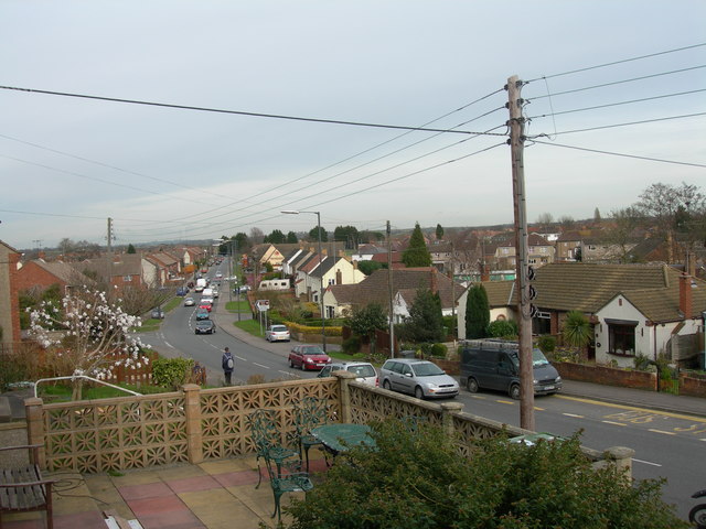
Westerleigh Road, Downend
This is the view looking down westerleigh Road towards the Avon Ring Road. You can see the Huntsman Pub.
 Map © Crown Copyright")
TIP: Click the map for more Large scale mapping
- Grid Square
- ST6577, 19 images (more nearby 🔍)
- Photographer
- Alice Hall (more nearby)
- Date Taken
- Monday, 12 March, 2007 (more nearby)
- Submitted
- Monday, 12 March, 2007
- Subject Location
-
OSGB36:
 ST 659 772 [100m precision]
WGS84: 51:29.5625N 2:29.5539W - Camera Location
-
OSGB36: ST 659 772
- View Direction
- East-northeast (about 67 degrees)