1966
NO3931 : South end of the Dundee Newtyle Railway's tunnel under the Law
taken 58 years ago, near to Dundee, Scotland
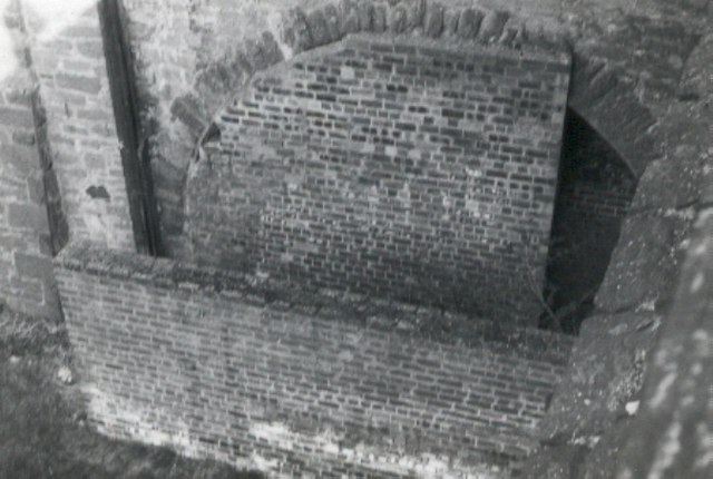
South end of the Dundee Newtyle Railway's tunnel under the Law
Built in the 1829, taken out of use in the 1860s, used as an air-raid shelter during World War II and covered over in 1982
 Map © Crown Copyright")
TIP: Click the map for more Large scale mapping
- Grid Square
- NO3931, 179 images (more nearby 🔍)
- Photographer
- Elliott Simpson (more nearby)
- Date Taken
- 1966 (more nearby)
- Submitted
- Tuesday, 13 March, 2007
- Subject Location
-
OSGB36:
 NO 395 311 [100m precision]
WGS84: 56:28.1369N 2:58.9361W - Camera Location
-
OSGB36: NO 396 312
- View Direction
- West-southwest (about 247 degrees)