2007
NB5637 : Loch an t-Siumpain
taken 17 years ago, near to Portvoller, Isle of Lewis And Harris, Na h-Eileanan an Iar, Scotland
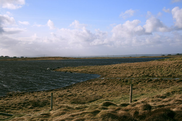
Loch an t-Siumpain
View of the North shore of Loch Tiumpain from the single track road to Tiumpain Lighthouse. In the distance you can make out the houses of Portnaguran.
 Map © Crown Copyright")
TIP: Click the map for more Large scale mapping
- Grid Square
- NB5637, 8 images (more nearby 🔍)
- Photographer
- Martin Collins (more nearby)
- Date Taken
- Tuesday, 13 March, 2007 (more nearby)
- Submitted
- Tuesday, 13 March, 2007
- Subject Location
-
OSGB36:
 NB 567 371 [100m precision]
WGS84: 58:15.3391N 6:8.8924W - Camera Location
-
OSGB36: NB 569 370
- View Direction
- West-northwest (about 292 degrees)