2005
SJ2867 : Derelict Farm Buildings
taken 19 years ago, near to Northop Hall, Flintshire/Sir y Fflint, Wales
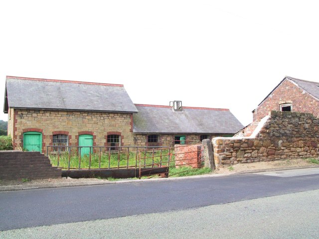
Derelict Farm Buildings
Dilapidated but somehow picturesque, this old farm is on the B5125 at Ewloe.
 Map © Crown Copyright")
TIP: Click the map for more Large scale mapping
- Grid Square
- SJ2867, 36 images (more nearby 🔍)
- Photographer
- Roger May (more nearby)
- Date Taken
- Thursday, 11 August, 2005 (more nearby)
- Submitted
- Thursday, 11 August, 2005
- Subject Location
-
OSGB36:
 SJ 284 673 [100m precision]
WGS84: 53:11.8820N 3:4.3592W - Camera Location
-
OSGB36: SJ 284 673
- View Direction
- South-southwest (about 202 degrees)