2013
NH1975 : Disappearing track
taken 11 years ago, 4 km S of Braemore, Highland, Scotland
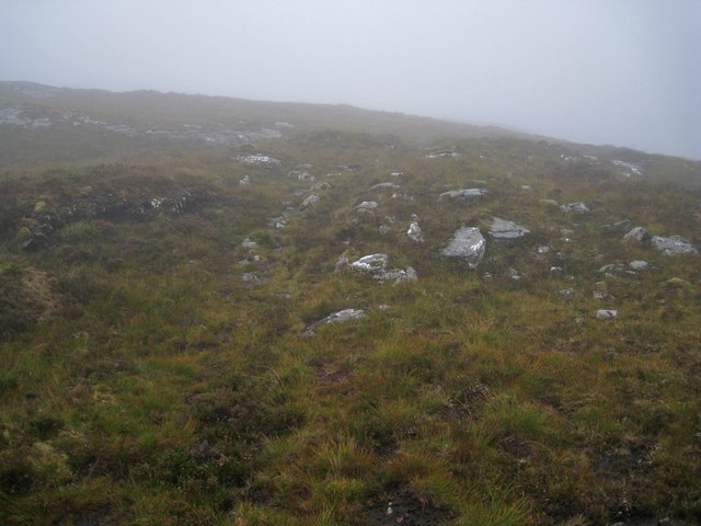
Disappearing track
A track I had been following through a bealach between Creag Dhubh and Meall a' Bhainne just about peters out here, though the map suggests it continues a bit further. However, in the drizzle and swirling mist encountered today, I decided the safest option was to head back down the hill the way I had come.
 Map © Crown Copyright")
TIP: Click the map for more Large scale mapping
- Grid Square
- NH1975, 6 images (more nearby 🔍)
- Photographer
- Richard Dorrell (more nearby)
- Date Taken
- Tuesday, 10 September, 2013 (more nearby)
- Submitted
- Wednesday, 11 September, 2013
- Subject Location
-
OSGB36:
 NH 1995 7534 [10m precision]
WGS84: 57:43.8958N 5:1.5389W - Camera Location
-
OSGB36: NH 1993 7544
- View Direction
- South-southeast (about 157 degrees)