2007
ST6958 : Footpath alongside the Cam Brook
taken 17 years ago, near to Carlingcott, Bath And North East Somerset, England
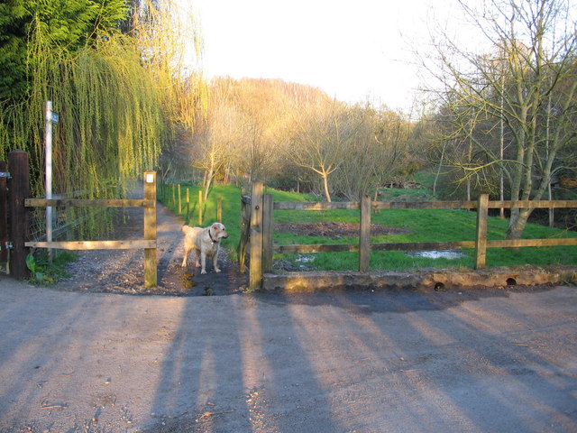
Footpath alongside the Cam Brook
A view looking to the east across Stoneage Lane towards the entrance to a public footpath alongside the Cam Brook (on the right). This footpath forms part of the route of the Limestone Link Link between the West Mendip Way and the Cotswold Way.
 Map © Crown Copyright")
TIP: Click the map for more Large scale mapping
- Grid Square
- ST6958, 34 images (more nearby 🔍)
- Photographer
- Phil Williams (more nearby)
- Date Taken
- Tuesday, 13 March, 2007 (more nearby)
- Submitted
- Wednesday, 14 March, 2007
- Subject Location
-
OSGB36:
 ST 696 585 [100m precision]
WGS84: 51:19.5139N 2:26.2514W - Camera Location
-
OSGB36: ST 696 585
- View Direction
- EAST (about 90 degrees)