2013
TR3259 : Richborough Road
taken 11 years ago, near to Great Stonar, Kent, England
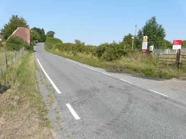
Richborough Road
Network Rail seems to have decided that the brick pillars of the former East Kent Light Railway, that once crossed the railway, represented a hazard to passing trains so all have been demolished, just leaving this one beside Richborough Road. This is from where I took my previous view TR3259 : Route of East Kent Light Railway over Richborough Road, almost four years ago.
 Map © Crown Copyright")
TIP: Click the map for more Large scale mapping
- Grid Square
- TR3259, 99 images (more nearby 🔍)
- Photographer
- John Baker (more nearby)
- Date Taken
- Tuesday, 27 August, 2013 (more nearby)
- Submitted
- Saturday, 14 September, 2013
- Subject Location
-
OSGB36:
 TR 3216 5958 [10m precision]
WGS84: 51:17.2804N 1:19.6880E - Camera Location
-
OSGB36: TR 3212 5950
- View Direction
- North-northeast (about 22 degrees)