2007
TQ0765 : River Thames: Desborough Channel
taken 17 years ago, near to Weybridge, Surrey, England
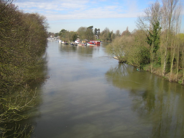
River Thames: Desborough Channel
The Desborough Channel was designed to improve navigation on the River Thames by cutting off the long loop between Weybridge and Walton. It is therefore strictly speaking a canal. Work commenced on the cut in 1930 but was not completed until 1935. It was designed to be 100 feet wide, and required the removal of about 800,000 cubic yards of material. It is named after Lord Desborough, who was then the Chairman of the Conservators of the river. This image is viewed looking upstream, towards the start of the cut, from the Upper Desborough Channel Bridge.
 Map © Crown Copyright")
TIP: Click the map for more Large scale mapping
- Grid Square
- TQ0765, 229 images (more nearby 🔍)
- Photographer
- Nigel Cox (more nearby)
- Date Taken
- Tuesday, 13 March, 2007 (more nearby)
- Submitted
- Thursday, 15 March, 2007
- Subject Location
-
OSGB36:
 TQ 079 659 [100m precision]
WGS84: 51:22.9142N 0:27.0556W - Camera Location
-
OSGB36: TQ 079 659
- View Direction
- WEST (about 270 degrees)