TQ7323 : Tudor Rose Cottage
taken 11 years ago, near to Robertsbridge, East Sussex, England
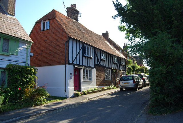
Robertsbridge is a village in East Sussex, England within the parish of Salehurst and Robertsbridge. It is approximately ten miles north of Hastings and thirteen miles south-east of Tunbridge Wells. The River Rother runs through the village.
The village dates back to 1176 when a Cistercian abbey was founded there by the Abbot, Robert de St Martin. When a market charter was granted in 1198 by Richard I to Robertsbridge it was the first recorded use of the name. The abbey was dissolved in 1538; however, the town flourished, and many of the oldest existing houses in the village date from the 14th and 15th centuries, including The Seven Stars Inn on the historic High Street. Robertsbridge is well served by transport links with the Robertsbridge station on the main railway line from Hastings to London and the A21 trunk road, although the latter has problems with transport delays. The opening of the Robertsbridge bypass, in 1989, relieved the village of constant traffic through it.
Robertsbridge Community College, a specialist Mathematics and Computer college, is the smallest such in East Sussex. Also, as well as the secondary school in the village, there is a primary school (Salehurst Church of England Primary). Among sports clubs is the Robertsbridge Rugby Football Club. Roberts bridge also has its own bonfire society.
 Map © Crown Copyright")
- Grid Square
- TQ7323, 469 images (more nearby 🔍)
- Photographer
- N Chadwick (more nearby)
- Date Taken
- Monday, 19 August, 2013 (more nearby)
- Submitted
- Thursday, 26 September, 2013
- Subject Location
-
OSGB36:
 TQ 7392 2362 [10m precision]
WGS84: 50:59.1427N 0:28.5911E - Camera Location
-
OSGB36: TQ 7390 2362
- View Direction
- East-northeast (about 67 degrees)