2013
ST5213 : Benchmark on the Holywell face of 'The Beeches'
taken 11 years ago, near to North Coker, Somerset, England
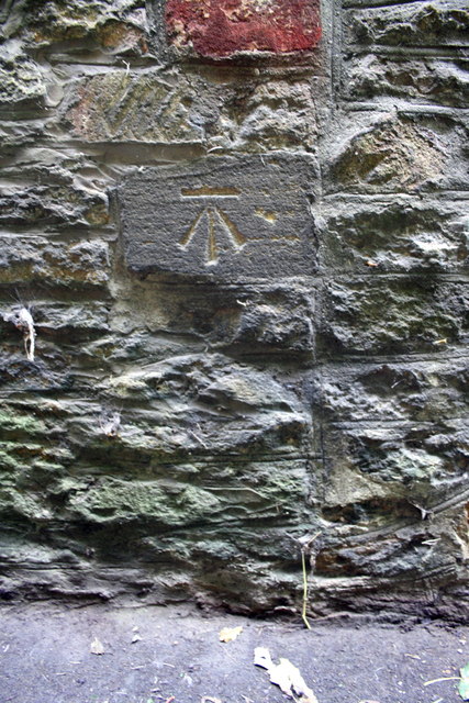
Benchmark on the Holywell face of 'The Beeches'
Ordnance Survey cut mark benchmark described on the Bench Mark Database at Link
 Map © Crown Copyright")
TIP: Click the map for more Large scale mapping
- Grid Square
- ST5213, 36 images (more nearby 🔍)
- Photographer
- Roger Templeman (more nearby)
- Date Taken
- Tuesday, 24 September, 2013 (more nearby)
- Submitted
- Saturday, 28 September, 2013
- Subject Location
-
OSGB36:
 ST 5283 1306 [10m precision]
WGS84: 50:54.9039N 2:40.3415W - Camera Location
-
OSGB36: ST 5283 1306
- View Direction
- West-northwest (about 292 degrees)