2007
TQ2697 : Covert Way
taken 17 years ago, near to Wrotham Park, Hertfordshire, England
This is 1 of 2 images, with title Covert Way in this square
Covert Way
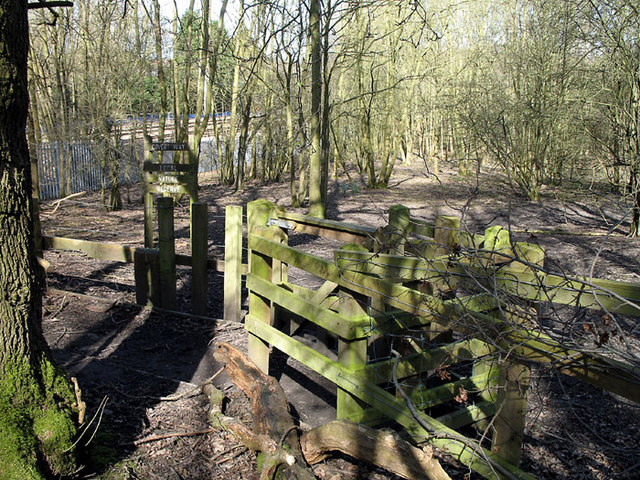
Covert Way is a local nature reserve to the south of Hadley Wood. A fence forms the boundary with Monken Hadley Common. There are several gates like this one to allow the free passage of walkers. The Kings Cross main line is visible through the trees.
 Map © Crown Copyright")
TIP: Click the map for more Large scale mapping
- Grid Square
- TQ2697, 51 images (more nearby 🔍)
- Photographer
- Martin Addison (more nearby)
- Date Taken
- Friday, 16 March, 2007 (more nearby)
- Submitted
- Friday, 16 March, 2007
- Subject Location
-
OSGB36:
 TQ 263 972 [100m precision]
WGS84: 51:39.6063N 0:10.4648W - Camera Location
-
OSGB36: TQ 263 972
- View Direction
- West-northwest (about 292 degrees)