2013
SO4208 : A40 Abergavenny junction ahead
taken 11 years ago, near to Raglan, Monmouthshire/Sir Fynwy, Wales
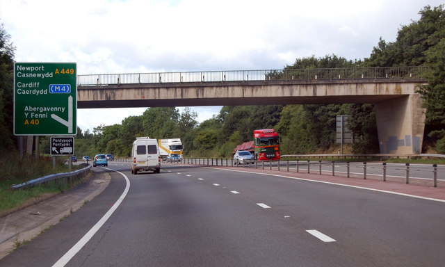
A40 Abergavenny junction ahead
The road becomes the A449 to the M4, Newport and Cardiff
A40 Road
The A40 road runs 256 miles from the City of London to Fishguard. It is a major trunk road and runs through High Wycombe, Oxford, Cheltenham, Ross on Wye, Abergavenny, Llandeilo and Carmarthen.
 Map © Crown Copyright")
TIP: Click the map for more Large scale mapping
- Grid Square
- SO4208, 45 images (more nearby 🔍)
- Photographer
- Julian P Guffogg (more nearby)
- Date Taken
- Friday, 9 August, 2013 (more nearby)
- Submitted
- Wednesday, 9 October, 2013
- Subject Location
-
OSGB36:
 SO 4280 0827 [10m precision]
WGS84: 51:46.2101N 2:49.8211W - Camera Location
-
OSGB36: SO 4287 0831
- View Direction
- Southwest (about 225 degrees)