1997
NZ5914 : Hutton Lane, near site of Hutton Gate station
taken 27 years ago, near to Guisborough, Redcar And Cleveland, England
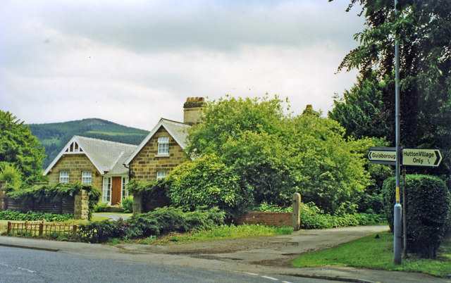
Hutton Lane, near site of Hutton Gate station
View SE to the edge of the Cleveland Hills (Cod Hill, 1,024 ft.). The station had been in the trees on the right and was on the ex-NER line from Middlesbrough to Guisborough, Brotton, Loftus, Whitby and Scarborough. The station had been closed 2/3/53, but a passenger service (Middlesbrough - Guisborough - Loftus only) continued until 2/5/60 and the line remained open for freight until 2/3/64.
 Map © Crown Copyright")
TIP: Click the map for more Large scale mapping
- Grid Square
- NZ5914, 25 images (more nearby 🔍)
- Photographer
- Ben Brooksbank (more nearby)
- Date Taken
- Tuesday, 24 June, 1997 (more nearby)
- Submitted
- Sunday, 13 October, 2013
- Subject Location
-
OSGB36:
 NZ 598 147 [100m precision]
WGS84: 54:31.4868N 1:4.5992W - Camera Location
-
OSGB36: NZ 597 148
- View Direction
- East-southeast (about 112 degrees)