2013
SZ3393 : Sand Bank Island Keyhaven
taken 11 years ago, near to Lower Pennington, Hampshire, England
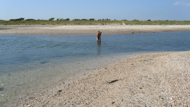
Sand Bank Island Keyhaven
A strong flow of water cuts of this little sandback Island at Keyhaven. The surface of the Island exposed at low tide is like quicksand in many places because of the waterlogged sand and clay.
 Map © Crown Copyright")
TIP: Click the map for more Large scale mapping
- Grid Square
- SZ3393, 52 images (more nearby 🔍)
- Photographer
- J W Parker (more nearby)
- Date Taken
- Saturday, 6 July, 2013 (more nearby)
- Submitted
- Sunday, 13 October, 2013
- Subject Location
-
OSGB36:
 SZ 3319 9304 [10m precision]
WGS84: 50:44.1618N 1:31.8627W - Camera Location
-
OSGB36: SZ 3321 9302
- View Direction
- Northwest (about 315 degrees)