2013
SN8256 : Forestry road north-west of The Devil's Staircase, Powys
taken 11 years ago, 5 km NW of Abergwesyn, Powys, Wales
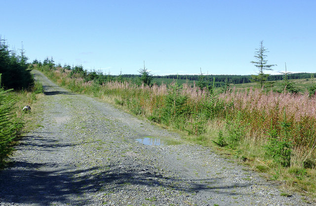
Forestry road north-west of The Devil's Staircase, Powys
The steep and tortuous public road up from Cwm Irfon is still climbing, hidden behind the rosebay willowherb flower/seed spikes to the right. Forestry to the right is in Cwm Nant y Cloddiad, and the forestry road shown joins the single track public road about three hundred metres ahead.
 Map © Crown Copyright")
TIP: Click the map for more Large scale mapping
- Grid Square
- SN8256, 85 images (more nearby 🔍)
- Photographer
- Roger D Kidd (more nearby)
- Date Taken
- Monday, 23 September, 2013 (more nearby)
- Submitted
- Sunday, 13 October, 2013
- Subject Location
-
OSGB36:
 SN 8265 5620 [10m precision]
WGS84: 52:11.4908N 3:43.0889W - Camera Location
-
OSGB36: SN 8270 5613
- View Direction
- Northwest (about 315 degrees)