2013
NN9585 : An incipient burn above the Geldie
taken 11 years ago, near to Allt Coire an t-Seilich [water Feature], Aberdeenshire, Great Britain
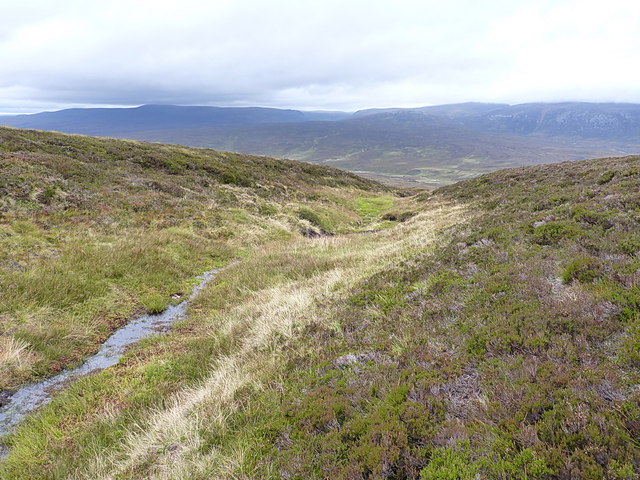
An incipient burn above the Geldie
Despite the lack of evidence on the map (although there is a shallow dry valley marked here) there's actually a fairly well defined burn beginning to form, draining the north side of the boggy bealach in Link
 Map © Crown Copyright")
TIP: Click the map for more Large scale mapping
- Grid Square
- NN9585, 4 images (more nearby 🔍)
- Photographer
- Richard Law (more nearby)
- Date Taken
- Saturday, 21 September, 2013 (more nearby)
- Submitted
- Monday, 14 October, 2013
- Subject Location
-
OSGB36:
 NN 9567 8521 [10m precision]
WGS84: 56:56.7809N 3:42.9982W - Camera Location
-
OSGB36: NN 95716 85104
- View Direction
- North-northwest (about 337 degrees)