2013
NY9253 : Probable mine spoil close to Embley Burn
taken 11 years ago, 4 km S of Whitley Chapel, Northumberland, England
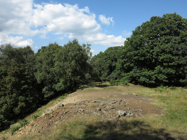
Probable mine spoil close to Embley Burn
Embley Burn is a tributary of Devil's Water, itself a feeder of the River Tyne. The image here shows a rib of land which has all the appearance of being mine spoil and in fact downhill, in the direction of the view and close to the meeting of Embley Burn and Devil's Water, mines are shown on OS maps. There's also some evidence of working on the ground there. OS mapping at the 1:50 000 scale does show an 'earthwork' here above the Embley Burn but at higher scales there's nothing. The contours at 1:25 000 however are shown broken and so do suggest a feature.
 Map © Crown Copyright")
TIP: Click the map for more Large scale mapping
- Grid Square
- NY9253, 17 images (more nearby 🔍)
- Photographer
- Trevor Littlewood (more nearby)
- Date Taken
- Monday, 26 August, 2013 (more nearby)
- Submitted
- Tuesday, 15 October, 2013
- Subject Location
-
OSGB36:
 NY 9264 5383 [10m precision]
WGS84: 54:52.7504N 2:6.9742W - Camera Location
-
OSGB36: NY 9267 5379
- View Direction
- North-northwest (about 337 degrees)