2013
TQ8138 : Bridleway towards Hammer Stream
taken 11 years ago, near to Cranbrook Common, Kent, England
This is 1 of 2 images, with title Bridleway towards Hammer Stream in this square
Bridleway towards Hammer Stream
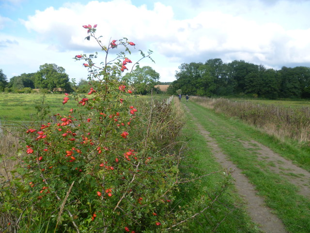
The treeline ahead marks the Hammer Stream. As befits a former hammer stream (helpfully still named 'Hammer Stream' on the map) this stream was very fast flowing. This was partly thanks to recent heavy rain after a long dry spell. The fruits on the bush hint at autumn.
This bridleway comes from Sissinghurst Castle and beyond the bridge leads uphill to a lane. The view over the bridge in the other direction can be seen at Link
This bridleway comes from Sissinghurst Castle and beyond the bridge leads uphill to a lane. The view over the bridge in the other direction can be seen at Link
 Map © Crown Copyright")
TIP: Click the map for more Large scale mapping
- Grid Square
- TQ8138, 41 images (more nearby 🔍)
- Photographer
- Marathon (more nearby)
- Date Taken
- Saturday, 12 October, 2013 (more nearby)
- Submitted
- Thursday, 17 October, 2013
- Subject Location
-
OSGB36:
 TQ 8130 3870 [10m precision]
WGS84: 51:7.1340N 0:35.3459E - Camera Location
-
OSGB36: TQ 8124 3861
- View Direction
- Northeast (about 45 degrees)