2013
ST2936 : Friarn Street benchmark
taken 11 years ago, near to Bridgwater, Somerset, England
This is 1 of 3 images, with title starting with Friarn Street in this square
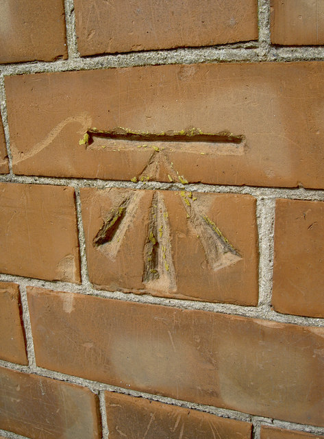
Friarn Street benchmark
A cutmark in the brickwork of number . The yellow crayon marks indicate that it had been used in the more recent past. See ST2936 : Friarn Street for a wider view and Link for the entry in the Benchmark Database.
 Map © Crown Copyright")
TIP: Click the map for more Large scale mapping
- Grid Square
- ST2936, 258 images (more nearby 🔍)
- Photographer
- Neil Owen (more nearby)
- Date Taken
- Thursday, 5 September, 2013 (more nearby)
- Submitted
- Saturday, 19 October, 2013
- Subject Location
-
OSGB36:
 ST 2981 3686 [10m precision]
WGS84: 51:7.6021N 3:0.2631W - Camera Location
-
OSGB36: ST 2981 3686
- View Direction
- Northwest (about 315 degrees)