2013
SE0266 : New Pasture Beck
taken 11 years ago, 3 km from Hebden, North Yorkshire, England
This is 1 of 2 images, with title New Pasture Beck in this square
New Pasture Beck
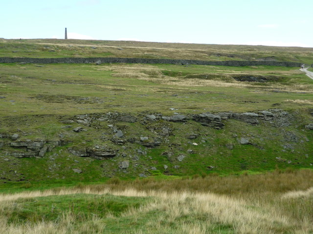
Taken on the pathway linking Old Moor Lane and Duke's New Road at the edge of Grassington Moor. Disused quarrying in the foreground and disused lead mine workings with chimney above and to the right (off picture).
 Map © Crown Copyright")
TIP: Click the map for more Large scale mapping
- Grid Square
- SE0266, 75 images (more nearby 🔍)
- Photographer
- Carroll Pierce (more nearby)
- Date Taken
- Sunday, 22 September, 2013 (more nearby)
- Submitted
- Monday, 21 October, 2013
- Subject Location
-
OSGB36:
 SE 0295 6634 [10m precision]
WGS84: 54:5.5773N 1:57.3834W - Camera Location
-
OSGB36: SE 0218 6640
- View Direction
- EAST (about 90 degrees)