2013
NX9472 : Larch Hill
taken 11 years ago, near to Islesteps, Dumfries And Galloway, Scotland
This is 1 of 2 images, with title Larch Hill in this square
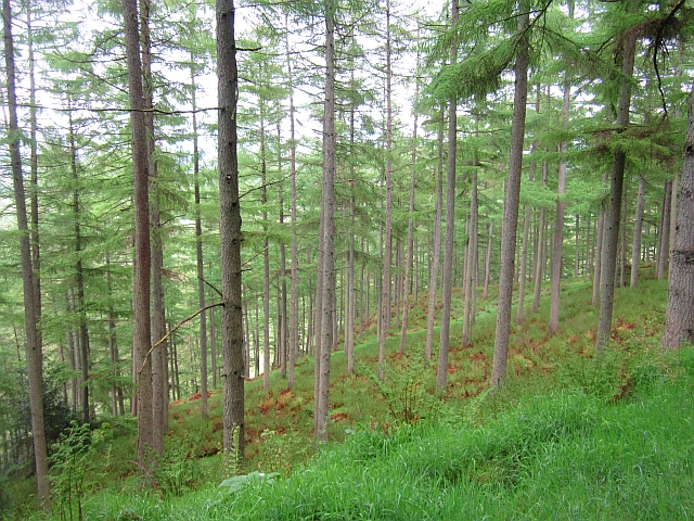
Larch Hill
A long established bit of Mabie Forest and called Larch Hill on 19th century maps. They have been growing larches here for a while. The slope is very steep.
 Map © Crown Copyright")
TIP: Click the map for more Large scale mapping
- Grid Square
- NX9472, 12 images (more nearby 🔍)
- Photographer
- Richard Webb (more nearby)
- Date Taken
- Thursday, 23 May, 2013 (more nearby)
- Submitted
- Tuesday, 22 October, 2013
- Subject Location
-
OSGB36:
 NX 9464 7212 [10m precision]
WGS84: 55:1.9440N 3:38.9971W - Camera Location
-
OSGB36: NX 9459 7214
- View Direction
- East-southeast (about 112 degrees)