2002
ST7862 : Dundas Aqueduct
taken 22 years ago, near to Monkton Combe, Bath And North East Somerset, England
This is 1 of 11 images, with title Dundas Aqueduct in this square
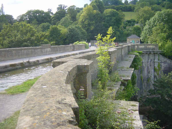
Dundas Aqueduct
Dundas Aqueduct carrying the Kennet and Avon Canal across the River Avon, looking west. On the other side of the aqueduct the short remaining section of the Somersetshire Coal Canal leads off to the left.
 Map © Crown Copyright")
TIP: Click the map for more Large scale mapping
- Grid Square
- ST7862, 181 images (more nearby 🔍)
- Photographer
- Martin Clark (more nearby)
- Date Taken
- August 2002 (more nearby)
- Submitted
- Saturday, 16 April, 2005
- Subject Location
-
OSGB36:
 ST 78 62 [1000m precision]
WGS84: 51:21.6694N 2:18.6109W