2013
SK2579 : Burbage Brook in Padley Gorge
taken 10 years ago, near to Nether Padley, Derbyshire, England
This is 1 of 7 images, with title Burbage Brook in Padley Gorge in this square
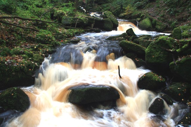
Burbage Brook in Padley Gorge
Burbage Brook drains the moorland to the north east and tumbles through the wooded Padley Gorge on its way to join the River Derwent at Grindleford.
There is a much greater flow than normal following heavy rain in the previous days.
There is a much greater flow than normal following heavy rain in the previous days.
 Map © Crown Copyright")
TIP: Click the map for more Large scale mapping
- Grid Square
- SK2579, 182 images (more nearby 🔍)
- Photographer
- Graham Hogg (more nearby)
- Date Taken
- Wednesday, 23 October, 2013 (more nearby)
- Submitted
- Saturday, 26 October, 2013
- Subject Location
-
OSGB36:
 SK 2539 7937 [10m precision]
WGS84: 53:18.6399N 1:37.2239W - Camera Location
-
OSGB36: SK 2537 7936
- View Direction
- East-northeast (about 67 degrees)