2006
NY7766 : The Long Stone
taken 18 years ago, near to Bardon Mill, Northumberland, England
This is 1 of 3 images, with title starting with The Long Stone in this square
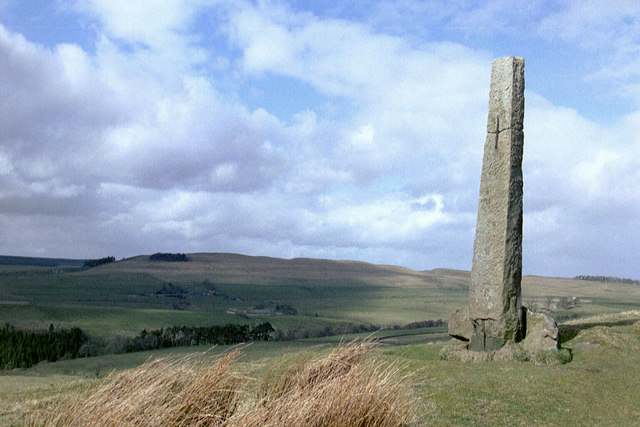
The Long Stone
The Long Stone stands at the west end of the ridge above Thorngrafton Common close to the site of a Roman signal station. The view (in the photo) to the north is of Hadrian's Wall running over Hotbank Crags. To the west there is a bird's eye view of Vindolanda.
 Map © Crown Copyright")
TIP: Click the map for more Large scale mapping
- Grid Square
- NY7766, 147 images (more nearby 🔍)
- Photographer
- Mike Quinn (more nearby)
- Date Taken
- March 2006 (more nearby)
- Submitted
- Tuesday, 20 March, 2007
- Subject Location
-
OSGB36:
 NY 778 664 [100m precision]
WGS84: 54:59.5012N 2:20.9098W - Camera Location
-
OSGB36: NY 778 664
- View Direction
- NORTH (about 0 degrees)