2013
SE0819 : Church Lane, Stainland, blocked by fence and shed
taken 10 years ago, near to Holywell Green, Calderdale, England
This is 1 of 5 images, with title starting with Church Lane in this square
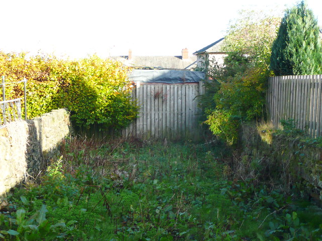
Church Lane, Stainland, blocked by fence and shed
Church Lane is an ancient highway and an unadopted street, so it was an unpleasant surprise to find it completely blocked by a high fence with what looks like a shed behind it.
 Map © Crown Copyright")
TIP: Click the map for more Large scale mapping
- Grid Square
- SE0819, 157 images (more nearby 🔍)
- Photographer
- Humphrey Bolton (more nearby)
- Date Taken
- Thursday, 7 November, 2013 (more nearby)
- Submitted
- Friday, 8 November, 2013
- Subject Location
-
OSGB36:
 SE 0839 1987 [10m precision]
WGS84: 53:40.5140N 1:52.4683W - Camera Location
-
OSGB36: SE 0839 1987
- View Direction
- East-northeast (about 67 degrees)