2013
SO7641 : Black Hill, The Malvern Hills
taken 10 years ago, near to Little Malvern, Worcestershire, England
This is 1 of 2 images, with title Black Hill, The Malvern Hills in this square
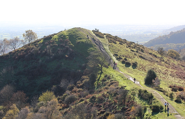
Black Hill, The Malvern Hills
Viewed from the slopes of Pinnacle Hill.
The remains of "Red Earl's Dyke" can be seen to the left of the peak.
The remains of "Red Earl's Dyke" can be seen to the left of the peak.
 Map © Crown Copyright")
TIP: Click the map for more Large scale mapping
- Grid Square
- SO7641, 450 images (more nearby 🔍)
- Photographer
- Bob Embleton (more nearby)
- Date Taken
- Sunday, 10 November, 2013 (more nearby)
- Submitted
- Wednesday, 13 November, 2013
- Subject Location
-
OSGB36:
 SO 7683 4129 [10m precision]
WGS84: 52:4.1694N 2:20.3660W - Camera Location
-
OSGB36: SO 7681 4190
- View Direction
- SOUTH (about 180 degrees)