2013
SO2819 : Path to Sugar Loaf
taken 10 years ago, near to Forest Coal Pit, Monmouthshire/Sir Fynwy, Wales
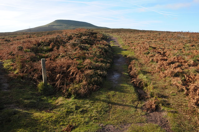
Path to Sugar Loaf
Path ascending Sugar Loaf from Forest Coal Pit to the east.
 Map © Crown Copyright")
TIP: Click the map for more Large scale mapping
- Grid Square
- SO2819, 17 images (more nearby 🔍)
- Photographer
- Philip Halling (more nearby)
- Date Taken
- Saturday, 23 November, 2013 (more nearby)
- Submitted
- Tuesday, 26 November, 2013
- Subject Location
-
OSGB36:
 SO 2806 1937 [10m precision]
WGS84: 51:52.0949N 3:2.7744W - Camera Location
-
OSGB36: SO 2810 1940
- View Direction
- Southwest (about 225 degrees)